If you have ever found a great fishing area and wished you could return to the exact same spot, you already understand the value of waypoints. In the United States, many anglers use GPS units, fish finders, and mobile apps to save locations where they find fish, structure, or safe travel routes.
Understanding what are fishing waypoints helps both new and experienced anglers use modern electronics with confidence. A waypoint is more than a dot on a screen. It is a digital note that stores a location and helps you build knowledge about the water you fish.
What Are Fishing Waypoints and How Do They Work?
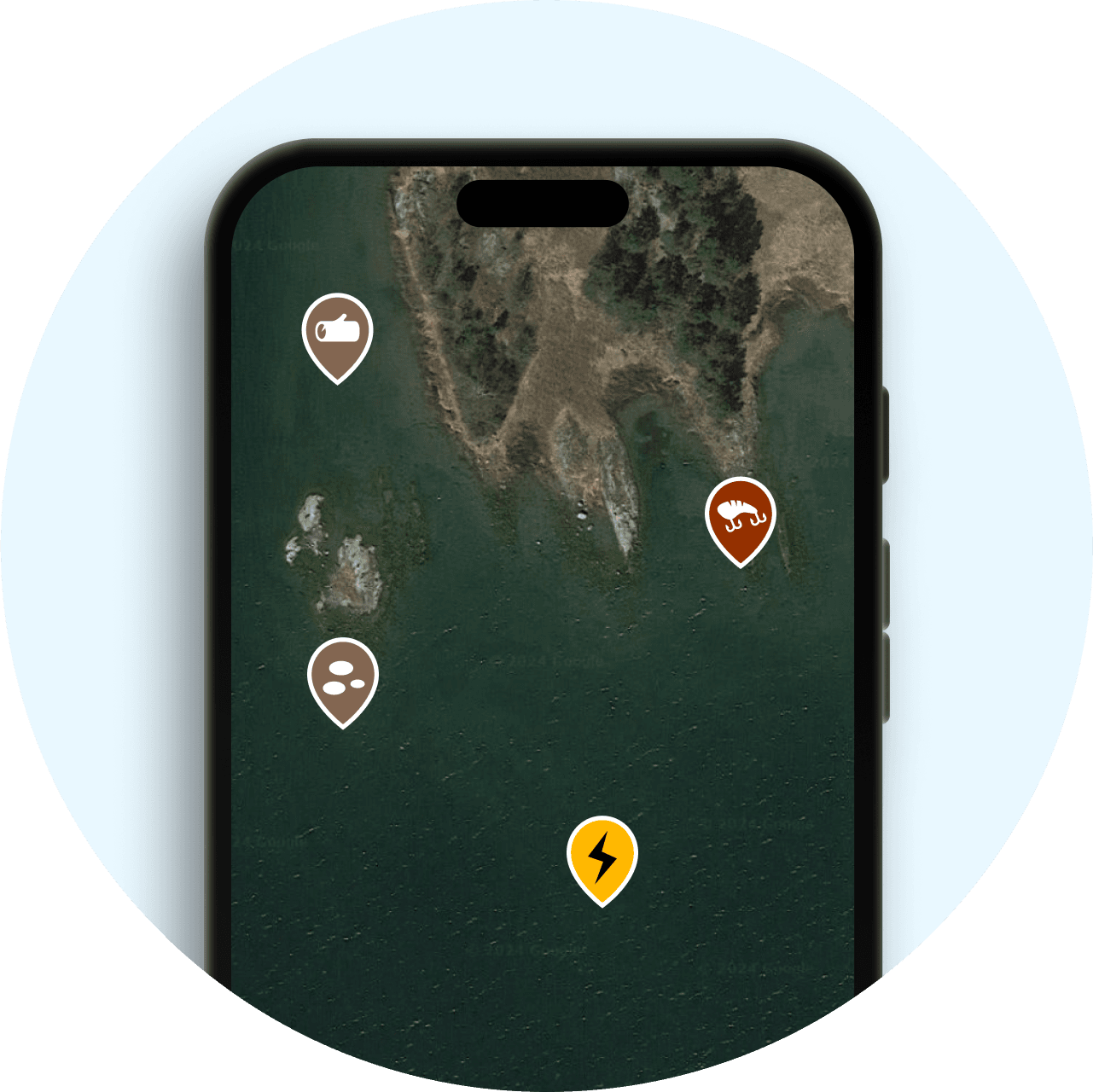
When learning what are fishing waypoints, the simplest explanation is that they are saved GPS coordinates. Your device records a specific location on the water and lets you return to it later.
A waypoint can mark many things, including a productive fishing hole, a reef, a brush pile, a drop-off, a dock, or a safe channel. Most modern fish finders and GPS chartplotters allow anglers to save these points with a simple button press.
- ✦ GPS location data
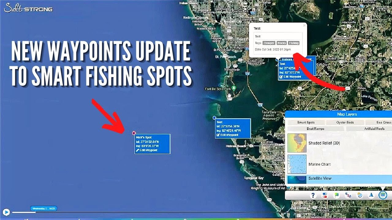
A waypoint stores latitude and longitude information so your electronics can guide you back to the exact location.
- ✦ Personal fishing records
Anglers often add names, notes, and symbols to remember why a location matters.
Why GPS Accuracy Matters for Fishing
A few feet can make a big difference when fishing near small structures. Accurate GPS helps you return to the same casting area instead of searching again.
- ✦ Better repeat trips
Accurate waypoints help you revisit proven areas during future fishing trips.
Types of Fishing Waypoints Anglers Commonly Use
Fishing waypoints are not limited to one type of location. Skilled anglers create different categories to organize their information and improve future trips.
A well-organized waypoint collection becomes a digital fishing journal. It helps you remember seasonal patterns, productive areas, and important water features.

- ✦ Fish-catching locations
These waypoints mark places where anglers have caught fish, such as bass spots, offshore reefs, or shallow flats.
- ✦ Structure locations
Structure waypoints identify underwater features like rocks, trees, ledges, and artificial reefs.
- ✦ Navigation markers
These points help mark ramps, hazards, channels, and safe travel routes.
How Anglers Create Fishing Waypoints
Creating fishing waypoints is simple with most modern marine electronics. Many anglers save a waypoint when they notice fish activity, interesting bottom changes, or a successful catch.
The best waypoint systems include extra details. Instead of saving a location as a random number, experienced anglers add useful information that helps them make better decisions later.

- ✦ Mark while fishing
Press the waypoint button when you find a promising area or catch fish.
- ✦ Add clear labels
Use names like ‘spring bass point’ or ‘deep ledge’ instead of unclear labels.
- ✦ Record conditions
Notes about weather, season, depth, and bait can make future trips more productive.
Using Fish Finders and Chartplotters
Most modern fish finders combine sonar and GPS features. This allows anglers to mark exact locations while viewing underwater information at the same time.
- ✦ Integrated electronics
Combination units allow faster marking and easier waypoint management.
Benefits of Using Fishing Waypoints
Knowing what are fishing waypoints is useful because they save time and improve consistency. Instead of relying only on memory, anglers can build a reliable map of their experiences.
Many recreational and professional anglers use waypoint systems to track patterns across different seasons and conditions.

- ✦ Find productive areas faster
Saved locations reduce searching time and help anglers focus on fishing.
- ✦ Repeat successful techniques
Waypoints allow anglers to return to locations where certain methods worked before.
- ✦ Improve trip planning
Saved points help organize routes and create more efficient fishing plans.
How to Organize Fishing Waypoints Like a Pro
A large collection of saved locations can become confusing without organization. Professional anglers often create categories based on species, seasons, water depth, or fishing conditions.
Good waypoint management turns simple GPS marks into valuable fishing knowledge. It also makes it easier to find important locations when preparing for a trip.
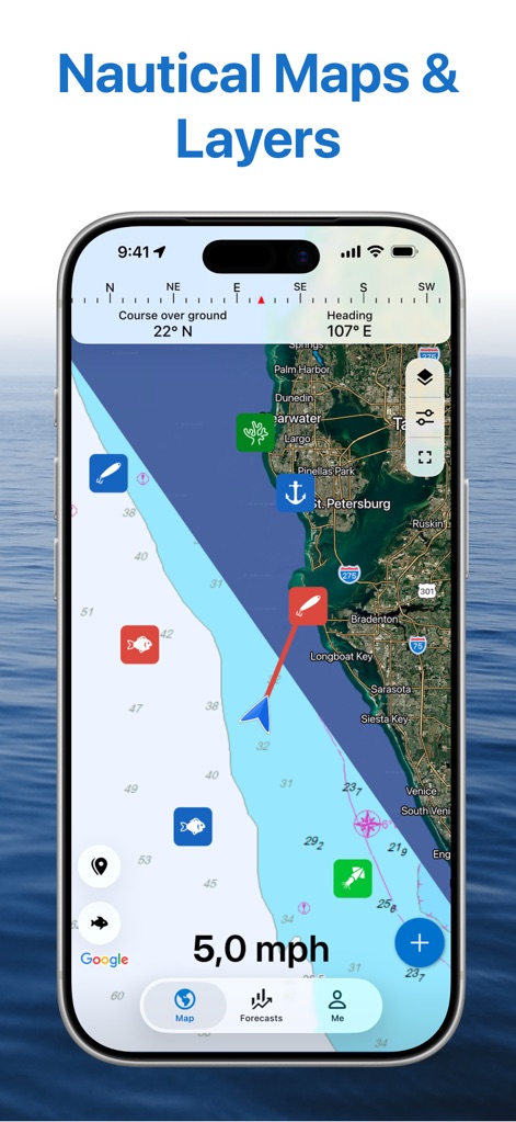
- ✦ Use categories
Separate waypoints by species, location type, or fishing style.
- ✦ Backup your data
Save waypoint files to another device or account to prevent losing valuable information.
- ✦ Remove old points
Delete useless or duplicate waypoints to keep your maps easy to read.
Private and Shared Waypoints
Some anglers keep their best fishing waypoints private, while others share locations with friends or fishing communities. Always respect local rules and personal agreements when sharing fishing information.
- ✦ Personal fishing libraries
Private waypoint collections help anglers build long-term knowledge.
Common Mistakes When Using Fishing Waypoints
Even though waypoints are easy to create, mistakes can reduce their value. Poor labeling, inaccurate marks, and missing notes can make saved locations difficult to use.
Learning what are fishing waypoints also means learning how to manage them correctly. A good system keeps your information useful for years.
- ✦ Saving random points
Avoid creating many waypoints without knowing why they matter.
- ✦ Ignoring updates
Fishing areas change because of weather, seasons, and environmental conditions.
- ✦ Not checking accuracy
Confirm important locations before relying on them during a trip.