Learning how to use lake maps for fishing can change the way you approach a new body of water. Instead of guessing where fish might be, you can study the lake before leaving home and create a plan based on depth, cover, and seasonal patterns.
Many experienced anglers use lake maps as a first step before a fishing trip. A good map can reveal hidden features such as drop-offs, underwater points, creek channels, and flats that are not visible from the surface.
What Are Lake Maps and Why Do Anglers Use Them?
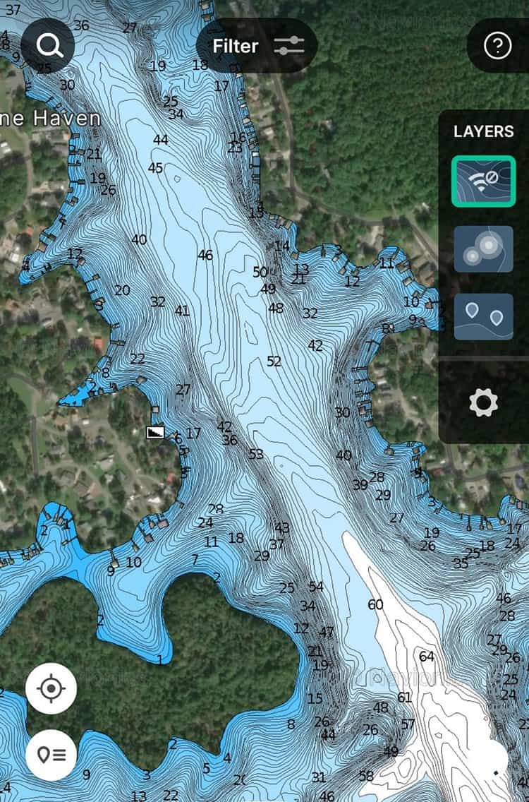
Lake maps are visual guides that show underwater features, shoreline details, and water depths. Modern fishing maps often include contour lines, GPS points, access locations, and updated satellite views.
Understanding how to use lake maps for fishing gives anglers an advantage because fish often relate to specific underwater features. Bass may hold near points and cover, while trout may follow deep channels and temperature changes.
- ✦ Depth information
Maps show how deep different areas are and help anglers find shallow zones, deep water, and transition areas.
- ✦ Underwater structure
Maps reveal features like humps, ridges, channels, and drop-offs where fish often feed or rest.
- ✦ Trip planning
Anglers can mark promising areas before reaching the lake and spend more time fishing productive spots.
Paper Maps vs Digital Fishing Maps
Traditional paper maps remain useful because they provide a simple overview of a lake. Digital maps add tools like GPS tracking, saved waypoints, and real-time navigation.
Many U.S. anglers now use mobile fishing apps and boat electronics together. This allows them to study a lake map at home and follow their plan on the water.
- ✦ Paper map benefit
Paper maps are easy to study and do not depend on batteries or internet access.
- ✦ Digital map benefit
Digital maps allow quick updates, GPS marking, and easier location tracking.
Learn How to Read Depth Contour Lines on Lake Maps
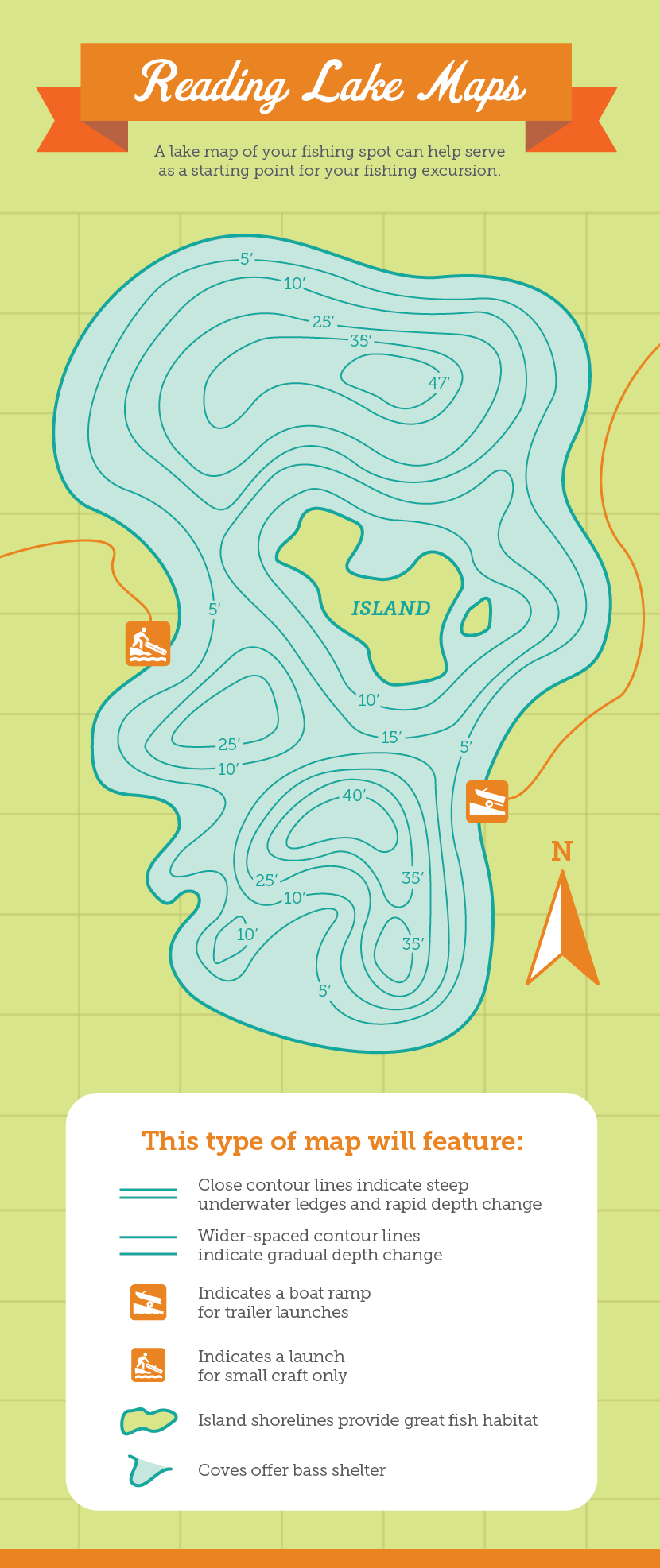
Contour lines are one of the most important parts of a fishing map. These lines connect areas with the same depth and help anglers understand the underwater shape of a lake.
When learning how to use lake maps for fishing, focus on areas where contour lines are close together. These spots show steep depth changes, which often create valuable fish habitat.

- ✦ Tight contour lines
Close lines indicate steep slopes, cliffs, or drop-offs where fish may move between depths.
- ✦ Wide contour spacing
Large spaces between lines usually show flatter areas such as flats or gradual slopes.
- ✦ Depth changes
Sudden changes in depth often attract baitfish and predators.
Finding Productive Depth Zones
Fish depth changes throughout the year. In spring, many species move into shallow areas. During hot summer months, fish may spend more time near deeper water.
A lake map helps you identify these zones before you start fishing. This saves time and helps you adjust your approach based on the season.
- ✦ Spring pattern
Look for shallow bays, protected areas, and warming water zones.
- ✦ Summer pattern
Search deeper edges, channels, and shaded structure.
How to Find Fish-Holding Structure Using Lake Maps
Fish rarely spread evenly across a lake. They often gather around structure that provides food, protection, or easier access to different depths.
When studying how to use lake maps for fishing, search for features that create natural stopping points. These areas are often worth checking first.
- ✦ Points
Underwater points extend into deeper water and can act as travel routes for fish.
- ✦ Creek channels
Old channels create depth changes and can attract fish during many seasons.
- ✦ Humps and islands
Raised underwater areas can hold fish because they provide feeding opportunities.
- ✦ Vegetation areas
Weed beds provide cover and attract small fish that predators follow.
Using Structure Maps for Bass Fishing
Bass anglers often study maps to find areas where shallow and deep water meet. These transition zones give bass easy access to feeding areas and escape routes.
A good strategy is to mark several nearby structures and test them with different lures instead of staying at one location too long.
- ✦ Look for transitions
Edges between flats and deep water often attract active bass.
Combine Lake Maps With GPS and Fish Finders
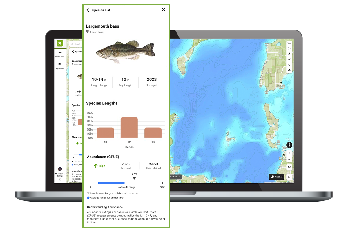
Lake maps become more powerful when combined with GPS and sonar technology. A map shows where features are located, while sonar helps confirm what is actually below your boat.
Many anglers save waypoints after finding productive areas. Over time, these saved locations create a personal fishing database.
- ✦ Mark successful spots
Save locations where you catch fish so you can return during similar conditions.
- ✦ Compare map and sonar data
Use sonar to confirm depth, cover, and fish activity around mapped features.
- ✦ Plan efficient routes
GPS helps you move between promising areas without wasting fishing time.
Why Digital Mapping Tools Matter
Digital fishing maps can provide updated information and help anglers explore unfamiliar lakes. They are especially useful when traveling to new states or large reservoirs.
The best results come from using technology as a guide while still paying attention to weather, water conditions, and fish behavior.
How to Use Lake Maps for Fishing Different Species
Different fish species use lakes in different ways. Learning their habits helps you interpret maps more effectively.
A map does not show fish locations directly, but it reveals the places where fish are most likely to spend time.
- ✦ Bass
Search for points, vegetation, docks, and structure near changing depths.
- ✦ Trout
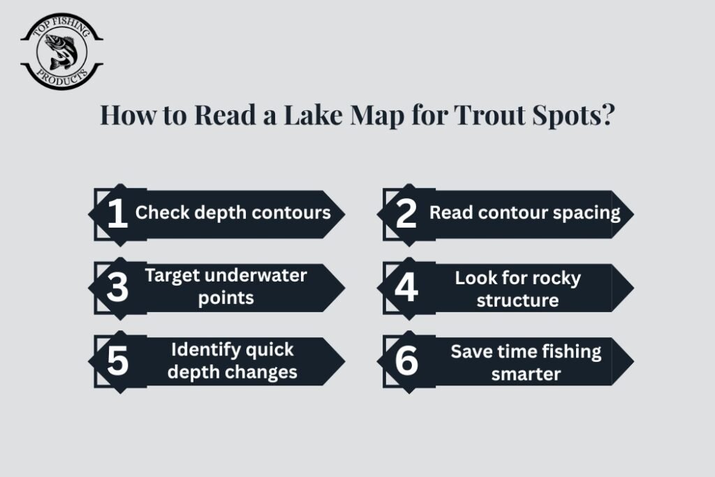
Look for deep water, cool zones, and areas with steady food sources.
- ✦ Walleye
Focus on rocky points, humps, and transition areas.
- ✦ Crappie
Target brush, submerged trees, and shallow spawning areas.