Learning how to find points on a lake can change the way you approach fishing. A point is a section of land that extends into the water. Many points continue underwater and create a natural path where fish move between shallow and deep areas.
Experienced anglers often start with a map before making their first cast. A good lake map can reveal hidden points, underwater ridges, and steep drop-offs that are hard to see from the boat. These areas can hold bass, walleye, crappie, and many other freshwater fish species.
What Is a Point on a Lake and Why Does It Matter?
A lake point is a piece of shoreline that reaches outward into the water. Some points are easy to see from shore, while others are hidden below the surface. These underwater extensions are often called submerged points.
Fish use points because they connect different lake zones. A point can act as a highway where fish move from deep water to shallow feeding areas. This makes learning how to find points on a lake useful for anglers who want to spend less time searching.
- ✦ Fish movement paths
Points often create routes between spawning areas, feeding zones, and deeper water.
- ✦ Natural ambush locations
Predator fish can use the edge of a point to hide and attack passing baitfish.
- ✦ Year-round value
Many points can produce fish during different seasons because they offer changing depths.
Main Lake Points vs Secondary Points
Main lake points extend from the shoreline into larger open water areas. They often attract fish because they are connected to deeper channels.
Secondary points are found inside bays or near smaller creek arms. These areas can become important during seasonal movements, especially when fish move into shallow water.
- ✦ Main lake points
Usually have deeper water nearby and can hold fish throughout the year.
- ✦ Secondary points
Often become productive during spring and early summer fishing periods.
Use Lake Maps to Find Productive Points Before Fishing
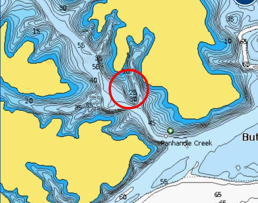
One of the easiest answers to how to find points on a lake is learning to read a lake map. Paper maps, digital maps, and fishing apps can show shoreline shapes and underwater contours.
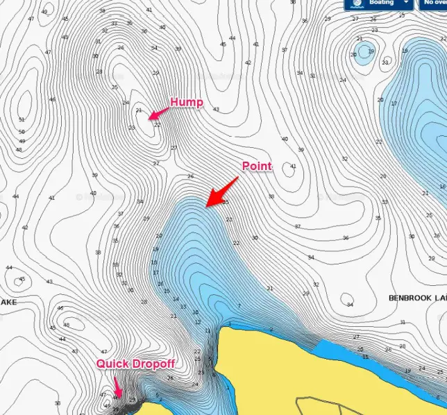
Look for areas where the shoreline creates a triangle shape or where contour lines push outward into deeper water. Tight contour lines often show steep drops, while wider lines usually show gradual slopes.
- ✦ Study contour lines
Contour lines reveal underwater hills, points, channels, and depth changes.
- ✦ Find connecting channels
Points near old creek channels often attract fish because they provide travel routes.
- ✦ Mark possible spots
Save promising points as waypoints so you can return during future trips.
Reading Topographic Features on Fishing Maps
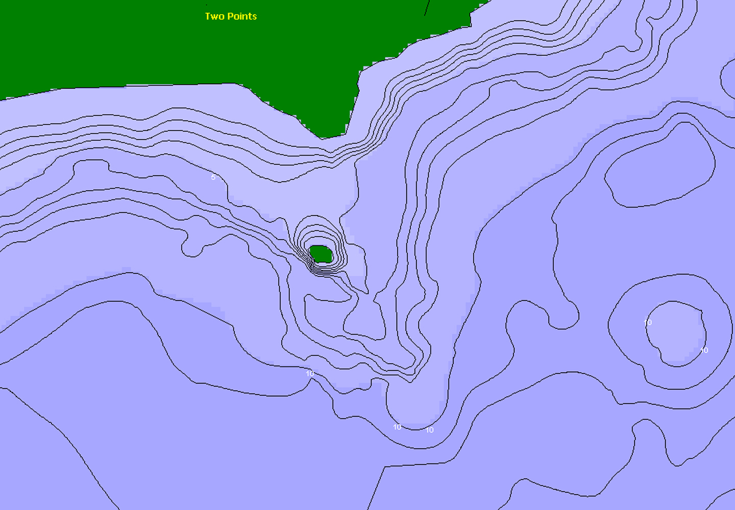
Topographic maps use lines to show changes in underwater depth. Anglers can use these lines to predict where fish may hold.
A point with a sharp drop nearby is often more valuable than a flat point because fish can quickly move between depths.
- ✦ Close contour lines
These usually indicate a steep underwater drop.
Look for Shoreline Shapes That Create Natural Lake Points
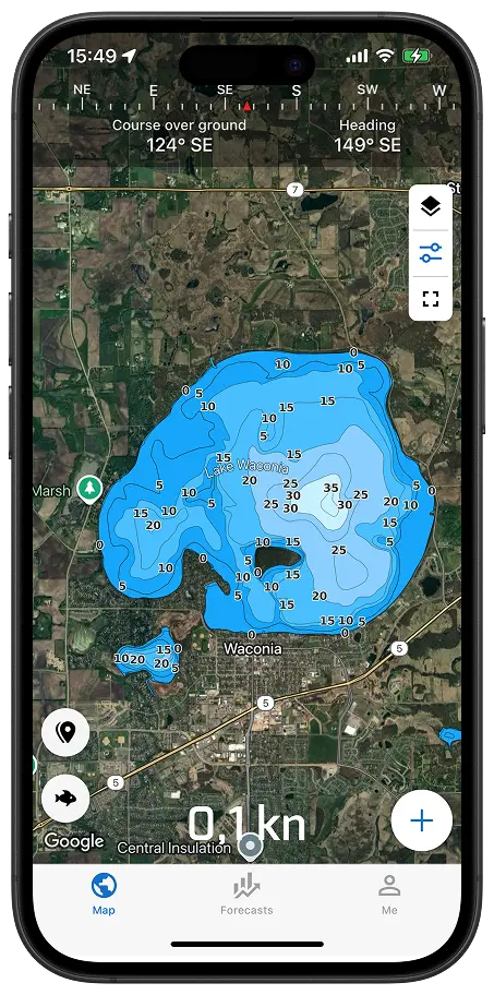
You can often find points by studying the shoreline from a boat or satellite view. Look for sections where the land pushes outward into the lake.
Rocky edges, tree lines, and changes in shoreline direction can reveal areas where underwater structure continues beyond the visible bank.
- ✦ Sharp shoreline turns
A sudden change in shoreline direction may create an underwater point.
- ✦ Creek entrances
Points near creek mouths often attract fish because food and water movement gather there.
Finding Hidden Submerged Points
Some of the best points are invisible from the surface. Old roadbeds, flooded hills, and submerged shorelines can continue underwater and create excellent fishing structure.
Modern mapping tools make it easier to discover these hidden features before you arrive.
- ✦ Satellite views
Aerial images can show old land shapes and possible underwater extensions.
Find the Features That Make a Lake Point Better
Not every point holds fish at the same level. The best points usually combine several features, such as depth changes, cover, and access to food.
When learning how to find points on a lake, focus on quality instead of quantity. One excellent point can produce more fish than many average locations.
- ✦ Depth change
Fish often hold where shallow water meets deeper water.
- ✦ Cover
Brush, rocks, grass, and timber can make a point more attractive.
- ✦ Wind exposure
Wind can push baitfish toward points and increase feeding activity.
Using Electronics to Confirm a Point
Fish finders and sonar units help confirm what maps suggest. They can show depth, bottom changes, and fish activity around a point.
A slow boat pass over a suspected point can reveal whether it has the structure you need.
- ✦ Sonar checks
Use sonar to verify depth changes and underwater structure.
How to Fish a Lake Point Once You Find One
Finding a point is only the first step. The next challenge is learning how fish use that area during different conditions.
Many anglers begin on the deeper side of a point and work toward shallow water. This approach helps cover the areas where fish may move throughout the day.
- ✦ Fish different depths
Try shallow, middle, and deep sections of the point to locate active fish.
- ✦ Change presentations
Use different lures and techniques based on water depth and fish behavior.
- ✦ Follow seasonal patterns
Fish locations can change as water temperature and weather change.
Common Mistakes When Fishing Points
Many anglers only fish the visible tip of a point. However, fish may hold along the sides or at the deeper end.
Another mistake is ignoring wind and current. These factors can decide whether a point becomes active or quiet.
- ✦ Ignoring depth changes
Flat points may be less productive than points with nearby drop-offs.