Learning how to find underwater contours is one of the most useful skills for anglers, boaters, and anyone who wants to understand what exists below the water surface. Underwater contours reveal the shape of the lake, river, or ocean floor by showing changes in depth and terrain.
In my experience studying fishing maps and using marine electronics, the biggest improvement comes from learning to connect map information with real conditions on the water. A contour line on a screen is not just a mark. It represents a change that can affect fish behavior, boat safety, and navigation.

What Are Underwater Contours and Why Do They Matter?
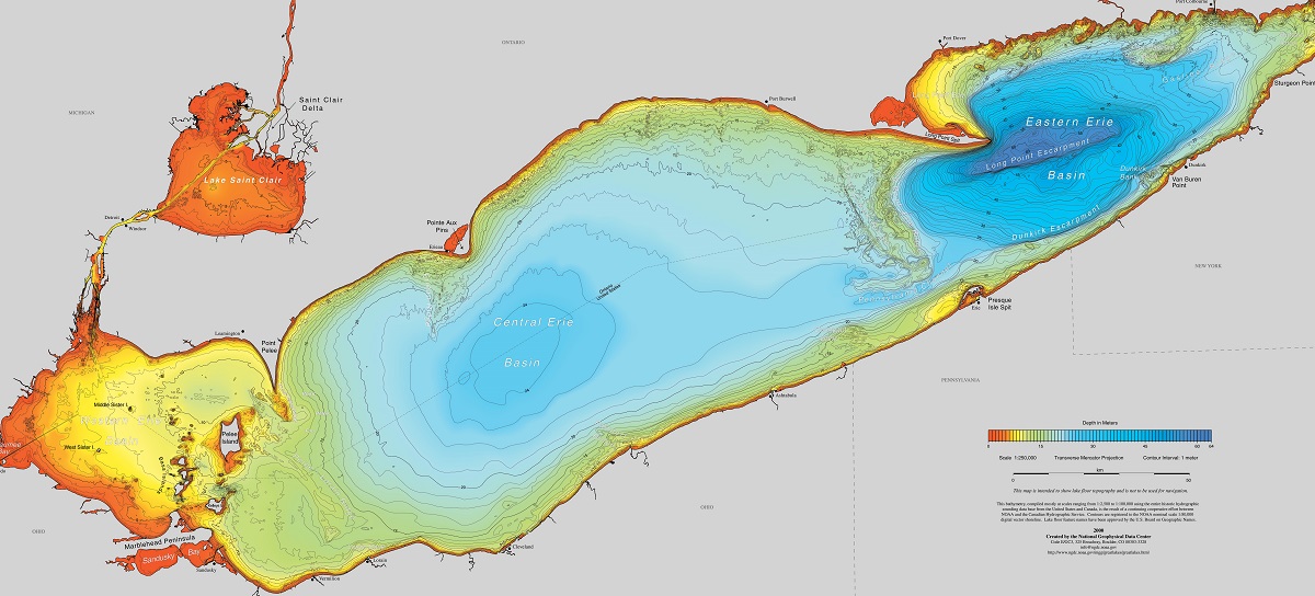
Underwater contours are lines on a map that connect points with the same water depth. They work like elevation lines on a land map, but they show the shape of the underwater landscape.
When you understand how to find underwater contours, you can identify important areas such as steep drops, shallow flats, underwater hills, and old river channels. These areas often influence where fish travel and where anglers choose to cast.
- ✦ Depth changes
Contour lines show where the bottom rises or falls, helping you locate changes in underwater terrain.
- ✦ Fish habitat clues
Many fish species use depth transitions because they provide food, shelter, and travel routes.
- ✦ Navigation benefits
Contour information helps boat operators avoid shallow areas and plan safer routes.
How Contour Lines Work on Maps
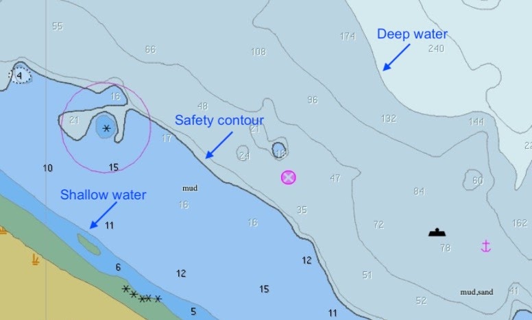
Each contour line represents a specific depth. Lines close together usually indicate a steep drop, while lines spread apart show a gradual slope.
Reading these patterns allows you to visualize the underwater shape before you ever launch your boat.
- ✦ Tight contour spacing
Close lines often mark steep banks, ledges, and drop-offs.
- ✦ Wide contour spacing
Wide spaces usually represent flatter bottom areas.
Use Bathymetric Maps to Find Underwater Contours
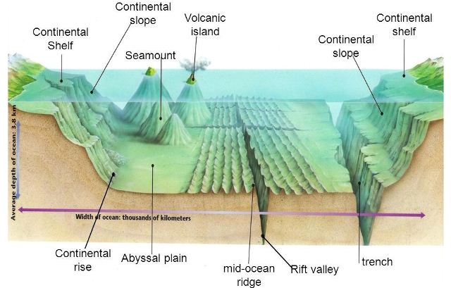
Bathymetric maps are one of the easiest tools for learning how to find underwater contours. These maps display underwater depth information and are available for many lakes, reservoirs, and coastal areas in the United States.
Modern fishing apps often combine contour maps with GPS location tracking. This lets anglers mark productive spots and return to them later.
- ✦ Check depth numbers
Look for labeled depths to understand how deep different areas are.
- ✦ Study contour patterns
Look for points, channels, humps, and sudden depth changes.
- ✦ Compare seasons
Water levels can change, so updated maps provide better results.
Popular Sources for Underwater Maps
Anglers commonly use digital mapping systems, government lake surveys, and marine navigation platforms. Many modern GPS units also include built-in contour databases.
A good map is a starting point, but actual water conditions should always be confirmed with electronics.
- ✦ Digital fishing apps
Mobile apps provide portable access to contour maps and saved fishing locations.
Find Underwater Contours With a Fish Finder and Sonar
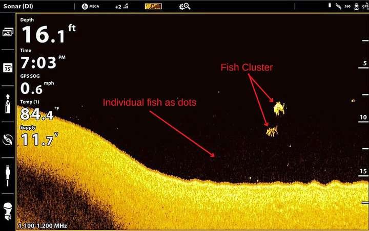
A fish finder gives you real-time information about underwater contours by sending sonar signals into the water. The returning signals create images of the bottom structure and depth changes.
When learning how to find underwater contours, sonar helps confirm whether a map matches the actual conditions beneath your boat.
- ✦ Side imaging
Side imaging helps reveal structure and terrain away from the boat path.
- ✦ Down imaging
Down imaging provides a detailed view directly below the boat.
- ✦ GPS mapping
GPS allows you to save locations and create personal fishing maps.
Combining Sonar Data With Maps
The strongest approach combines predicted contour information from maps with live sonar readings. This method helps you find changes that may not appear clearly on older charts.
Many experienced anglers spend time scanning an area before fishing because understanding the bottom saves time later.
- ✦ Scan before casting
Use sonar first to identify promising underwater features.
The Best Underwater Contour Features to Look For
Finding underwater contours is not only about locating depth changes. The goal is to identify features that create fish habitat or useful navigation points.
Certain contour shapes appear repeatedly on productive fishing waters across the United States.

- ✦ Drop-offs
Steep depth changes often attract fish because they provide access to multiple water depths.
- ✦ Points
Underwater points can act as travel routes where fish move between shallow and deep water.
- ✦ Humps
Raised underwater areas can provide feeding locations away from shore.
- ✦ Channels
Old creek and river channels often create important underwater pathways.
How Seasonal Changes Affect Contours and Fish Location
Fish movement changes throughout the year because water temperature, spawning cycles, and food sources change. The same contour area may produce different results in spring, summer, fall, and winter.
Studying contours over time helps anglers understand how fish use underwater terrain.
- ✦ Spring patterns
Fish often move toward shallower contour areas during spawning periods.
Common Mistakes When Reading Underwater Contour Maps
Many beginners learn how to find underwater contours but struggle because they only look at depth numbers. Depth alone does not tell the full story.
Successful map reading requires understanding how terrain, water movement, and fish behavior work together.

- ✦ Ignoring map updates
Old maps may not reflect current water levels or changes in underwater structure.
- ✦ Focusing only on deep water
Fish often use transition zones rather than the deepest areas.
- ✦ Skipping sonar verification
Real-time electronics help confirm what the map shows.